Mt Eden's railway station opened in 1880 - one of the original stations on the Northern Line.
In 1912 the island platform was established and a station building built. The original station building was removed in the 1990s and the station upgraded in 2004.
While the station was originally called Mt Eden, it is not in the Mt Eden Village but is closer to Eden Terrace/Symonds Street Newton.
The Newton area has generally been known as Te Uru Karaka after a significant grove of Karaka trees growing in the area in pre-European times. The area is also associated with a spring known as Te Ipu Pakore.
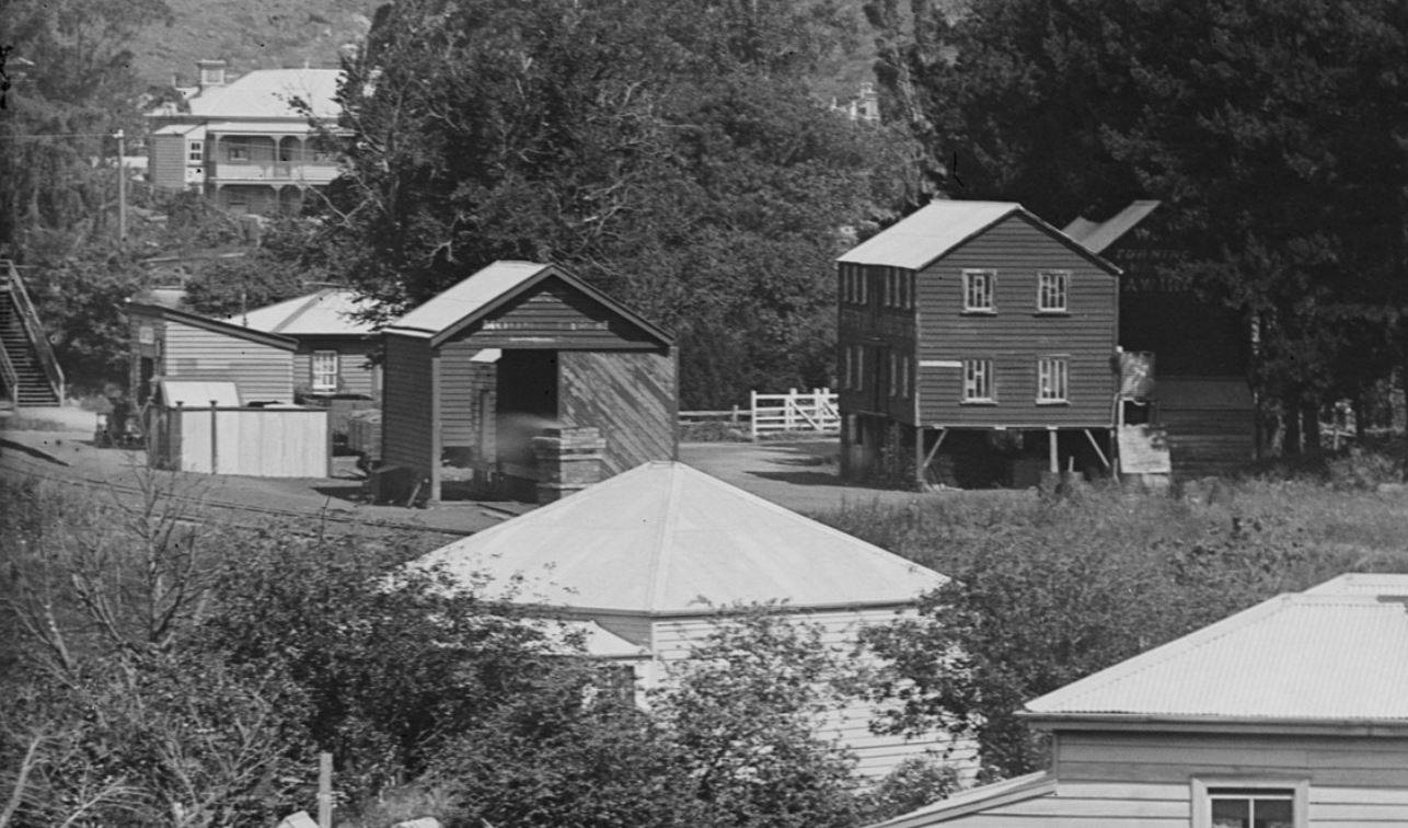
Before the 1870s there were several brick works in Newton Gully. As the nearby industry increased, the farm properties in the valley were subdivided and became working class communities.
Plans showing the early ownership of land within the area reveal that there were multiple purchases of allotments by wealthy individuals, many of whom were hoping to make a quick profit on speculative deals. By 1850, a number of well-to do houses dotted the landscape, establishing it as a recognisable and fashionable residential area.
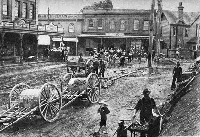
The junction of Upper Symonds Street, Newton Road, Khyber Pass and Mt Eden Road soon developed into a hub of shops and services. The area expanded with the advancement of industrial and commercial enterprises following the revival of the economy in the mid 1890s. Along with this was the constant upgrading of the roads necessitated by the arrival of the horse-trams in the 1880s and electric trams from 1902.
Around the same time an infrastructure was established to support that community, evidenced by the appearance of churches, hotels, schools, banks, a post office, fire station, halls and other public buildings.
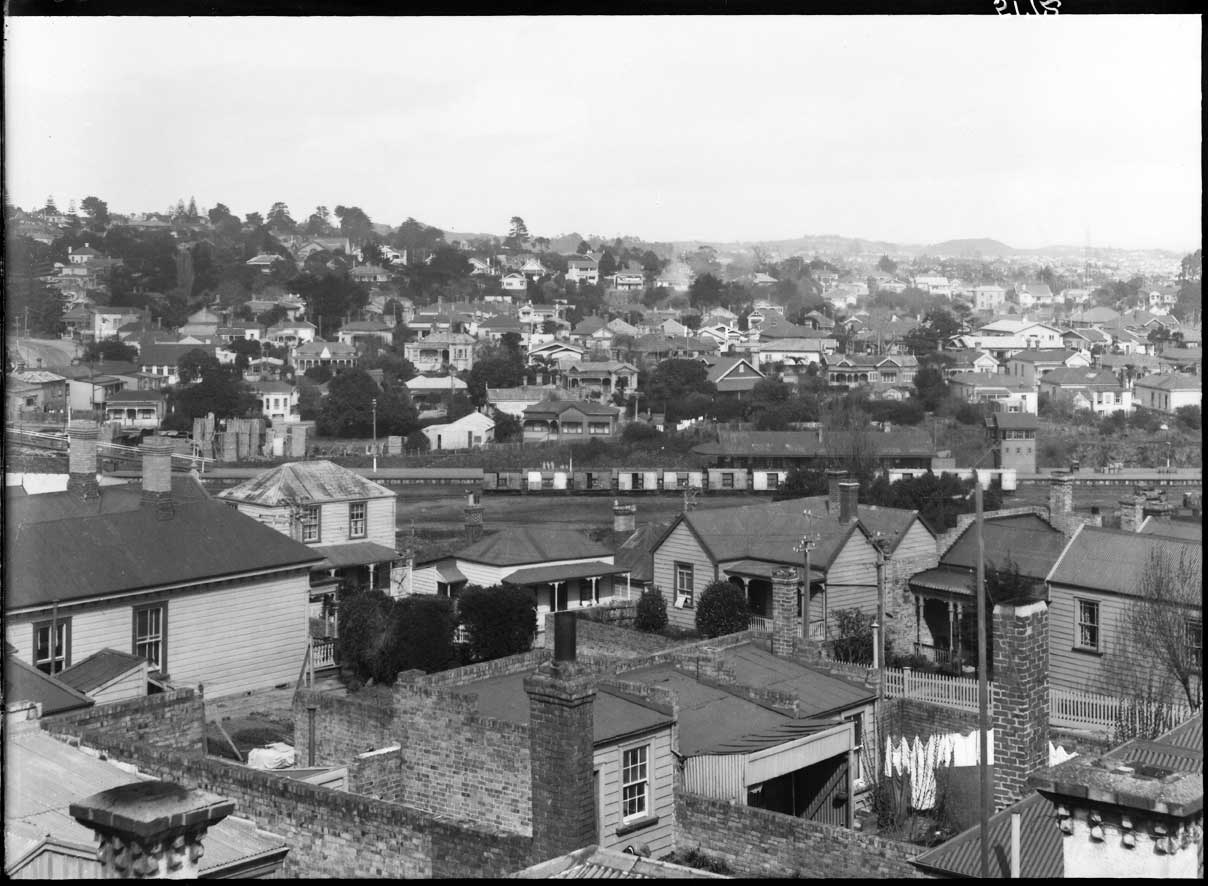
Large properties bought in the early decades were subdivided for suburban development. The slopes of Newton, during the latter part of the nineteenth century, were an intensely developed small suburb of wooden houses. Situated between the retail areas of Karangahape Road and Symonds Street, Newton was a fairly densely populated area, mainly of a working class nature with many boarding houses.
TRAMS ARRIVE: Laying tram lines near the corner of Mount Eden Road and New North Road, Eden Terrace in 1908 (Photo: Sir George Grey Special Collections, Auckland Libraries, 7-A4972)
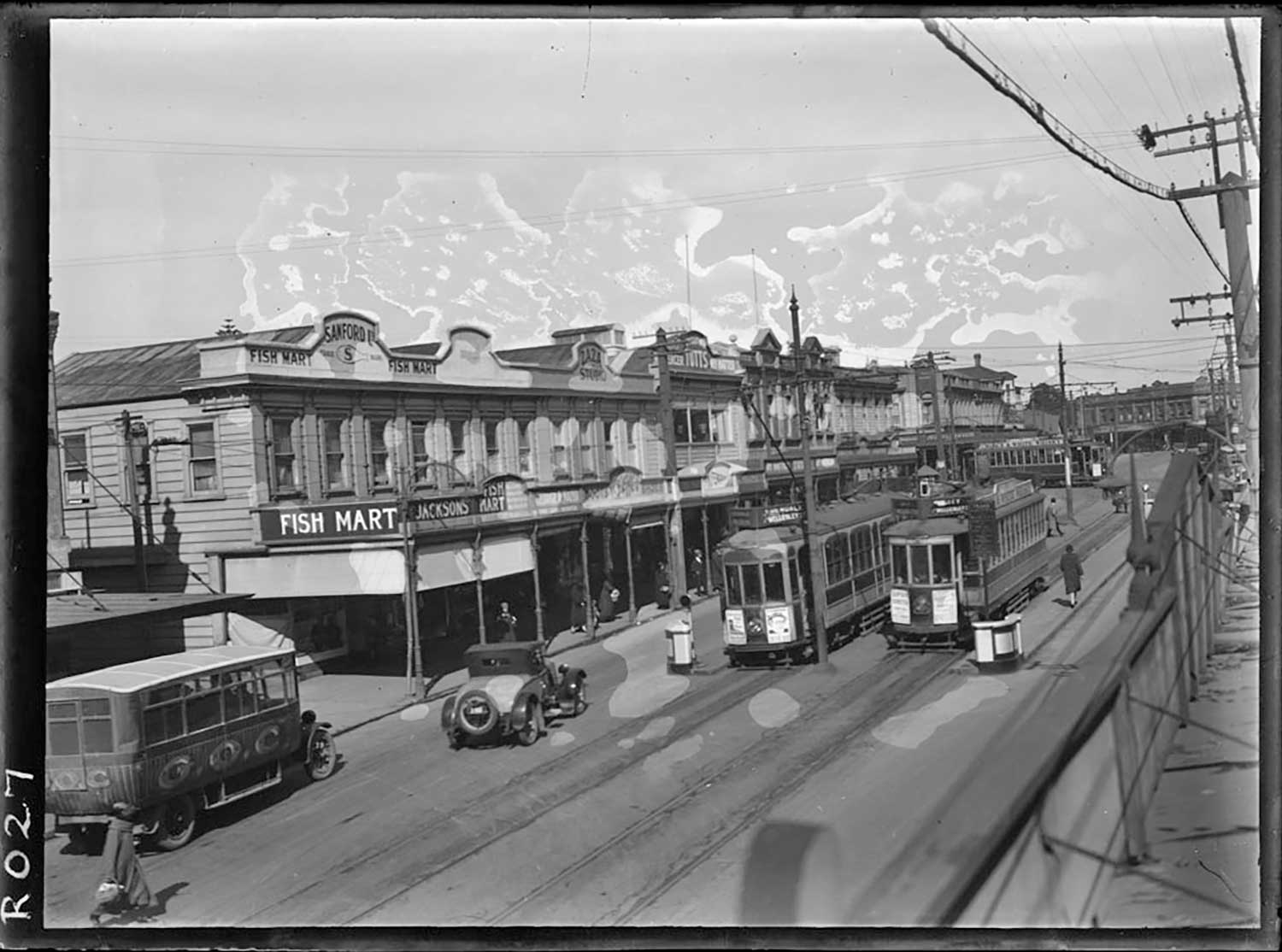
1925: Looking along Upper Symonds Street, showing trams and a bus running past the premises of Sanford Fish Mart (Photo: Sir George Grey Special Collections, Auckland Libraries, 35-R27)
Motorway arrives, houses go
Until the construction of the motorway system in the 1960s, the gully area was the location of several primary and intermediate level schools and about six churches.
In the 1950s, it was decided that Auckland needed a motorway, and the best path for it was right through Newton Gully.
MOTORWAY PLAN: This model of the proposed motorway interchange over Newton Gully was being displayed in the late 1950s (Photo: Sir George Grey Special Collections, Auckland Libraries, 580-3916)
SLUMS: Eden Terrace houses like this one in 1958 were labelled slums and earmarked for demolition (Photo: Sir George Grey Special Collections, Auckland Libraries, 580-3161)
Older residential areas identified as developing into "slums" were removed to create a passage for the motorway.
After the motorway was cut through, much of the remaining housing stock was utilised for light industrial use and often rebuilt for factory and warehouse uses.
PORTERS: Looking west along Porters Avenue in 1964 (Photo: Sir George Grey Special Collections, Auckland Libraries, 580-9427)
AERIAL: Eden Terrace in 1968 (Photo: Sir George Grey Special Collections, Auckland Libraries, NZ Map 7302)
Since the 1990s there has been a reverse trend of rebuilding in the area. The remnants of Newton soon turned from residential to commercial and the old houses were pulled down, replaced by commercial buildings. Other industrial buildings were converted for residential use including some turned into apartment blocks.
While the motorway may have eradicated the old residential, suburban Newton, a part of old Newton remains in the surviving villas, the street names and the old bluestone kerb stones. Slowly over the last fifteen years, people have started living in Newton again, especially in apartments and townhouses.
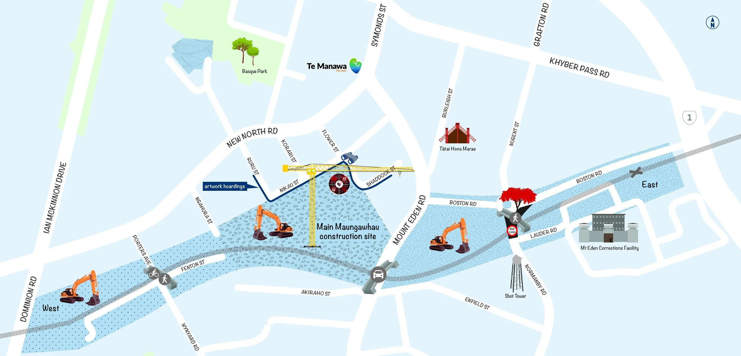
Grafton Station
The station is near our construction area - and St Peter’s College (SPC).

This train from Opua is about to cross the "pedestrian crossing". Students from St Peter’s College wait for the train to pass. The pathway is in the foreground (under the suitcase). Mt Eden Corrections Facility is in the background. (17 October 1957).
From the time the school opened in 1939, many students came from the western suburbs of Auckland, using the train service to attend the school. Until 1964 the nearest platform was Mount Eden station, a ten-minute walk to the school. By 1964 about 250 SPC students were using the train and walking between Mount Eden station and the school.
A teacher from SPC, Brother T. A. Monagle, approached the New Zealand Railways Department to request a station for the train outside the school. The college had several reasons for asking for a station, including vehicle traffic which had increased in the area, and to prevent accidents when the students were boarding the train.
The Minister of Railways at the time, Mr John McAlpine, came to see for himself and walked to Mount Eden station from the school. The visit was a success!
Boston Road railway station was built near SPC on the Western Line of the Auckland rail network, beneath the State Highway 1 overbridge. The first train stopped at this new station at 8.30am on Tuesday 15 September 1964.
The station later closed on 10 April 2010, the day after the opening of the new Grafton Station, built to better serve the central area including the hospital and local university developments. Thanks to Brother T. A. Monagle, SPC students continue to have direct access to the train station for their daily commute.

Two tracks at Boston Road, the Main Line and the Loop with train 53 to Helensville, the school train. (13 April 1964).